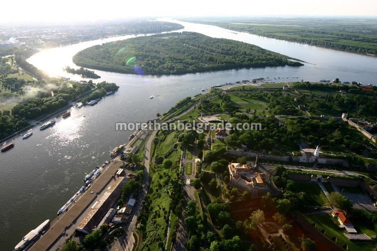
A large war island area is 210 hectares. It owes its name primarily to the rich war history of the region. During the siege of Belgrade that occurred in 1521, the Turks were the ones who organized their attacks, and in 1806, the Karadjordje insurrections on the island brought the guns used to fire Kalemegdan. They were not circumvented by Austro-Hungarians, who in 1915 also defended the border of their empire, Zemun and Tower at Gardoš. Although the Constantinople Convention in 1741, regulating the issue of the Danube and Sava aids, divided the island into the zones of interest between Turkey (Belgrade region) and Austria (the Zemun part) and imposed a strict ban on its use for military purposes, it is clear that these norms neither side did not respect.

By the end of the last century, that is, in 1948, fate was that the Danube had just saved the Great War Island from total destruction. The construction of New Belgrade began on wetland and inhospitable soil. It was planned that the land of the island be used to cover the swamps and arranging the terrain for construction, but this plan, fortunately, proved unfeasible. In addition, the Danube has constantly accumulated large quantities of sludge on the Great War Island. This made him unsuitable for the renovation of the New Belgrade construction site. It was, however, unfortunate, the Little War Island, which was located between the southern edge of the Great War Island and the coast of the country, from which only a narrow belt of 300 meters long and 60 meters wide was left today.

ZONE PROTECTION ON BIG WAR ISLAND
The Institute for Nature Protection of Serbia today recognizes three protection zones:
1. Nature protection zone (which has the character of a special nature reserve and covers the coastal zone of the island),
2. Recreation zone (which includes the interior parts of the island) and
3. Tourism zone (which includes the beach “Lido” with the planned extension).

• Nature protection zone (I level protection regime) has the character of a special nature reserve and covers the Small War Island as a whole, the coastal zone of the Great War Island, the forest complex, the wet areas within the Great War Island and the water surface around the Small War Island.
• Recreation zone (II level protection regime) includes the interior parts of the Great War Island, formerly arable land that is still used in this way, the meadow areas of the coast to the Danube, which are now partly occupied by illegally built facilities, as well as the location of the public harbor with controlled a public road and a 10 m wide protection zone linking this location to the Lido Beach.

• The third zone – the tourism zone encompasses the Lido Beach with a planned extension where tourist and recreational offer and new facilities can be organized.
